Learn the skills required for a Certificate of Land Surveyor
Our certificate course gives the knowledge and hands-on training for the profession of land surveying which is foundation of the infrastructure and building construction industry. The trainees will not only learn how to collect, interpret and map the land data of small scale to large scale construction projects using conventional instruments like Auto level, Theodolite and Total Station but equal emphasize will also be given on the collection, analysis and interpretation of geospatial data using advanced equipment as GPS, Remate sensing and Imagery data using GIS. This course is extremely beneficial for anyone who wants to excel in their careers in construction.
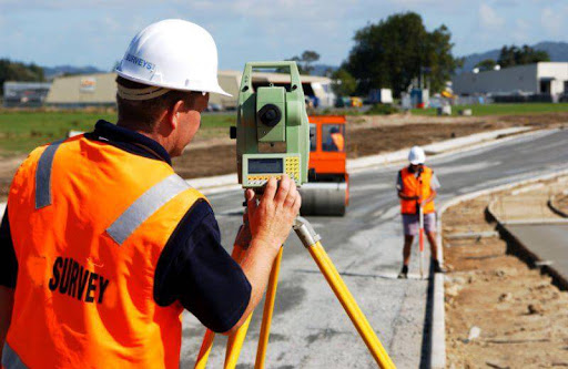
What You’ll Learn
The core purpose of this qualification is to produce employable and skilled manpower who can work in the field of land surveying according to national and international standards. In this course you will learn:
Fundamentals of surveying measurements to provide a broad overview of the surveying instrumentation including linear and angular tools and instruments.
Solving field-oriented surveying related problems using conventional and mathematical approaches with surveying tools.
Working with Traversing and Triangulation Methods of surveying along with plotting and mapping of compass survey maps.
Plane Table surveying for relatively small areas, instruments and methods of plan tabling.
Basics of leveling, leveling instruments and determination of reduced levels for various engineering purpose of different infrastructure projects including building, roads, tunnels etc.
Understanding the contouring, its instruments and methods to collect topographic data of plan and hilly areas, interpretation of data and preparation of contour maps.
Tacheometry for the horizontal and vertical distances in steep hilly areas to set up the horizontal and vertical control for the various construction projects.
Understanding the hydrographic survey, its necessity and importance, working with the hydrographic survey equipment for the determination of streams and rivers discharge by USGS methods.
Implementing the traversing and triangulation principles using Theodolite and Total Station equipment for large scale projects.
Understanding and implementing the concept of horizontal and vertical curves and setting out of the buildings using Total Station and GPS with and Introduction to the working environment of GIS.
How You’ll Benefit?
This course is taught by professionals having industrial experience.
You will learn how to work in a group with fellow students. Always observe ethical and social behavior during class and field work.
This course involves both supervised and self-directed learning built in your timetable. An instructor will be available for students’ guidance and support. This course will give you sufficient skills which can open new career opportunities for you.
This course is an opportunity to get familiar with the field oriented full fledge project based training course.
Potential Job Opportunities:
Students completing this course will have opportunities to work inside the country and in the fastest-growing construction industry in the Middle East. Upon completion of this course, the potential job opportunities include but are not limited to:
Land surveyor
Construction surveyor
Road surveyor
Topography surveyor